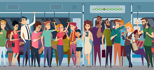
As the Delta variant accelerates the rate of new COVID-19 cases in many parts of the world, social distancing has regained high priority. To help people maintain a safe distance on public transit, Google Maps now offers transit crowdedness predictions in 10,000 cities across 100 countries through its mobile app.
That sounds good on paper, but having lived in NYC for more than a decade in the past, my New Yorker cynicism kicks in fast. What exactly can Google Maps really offer to seasoned subway riders? In a press release, Google explains that Maps has analyzed anonymous user data and historical trends to predict crowding patterns in city transit systems around the world. The results of this deep data dive show that mass transit in major US cities is typically standing room only between 7-8 am and 4-5 pm. Um, duh?
However, any long-time NYCer knows this truth: ultimately, the subway dances to the beat of its own drum. Train after crowded train can roll in midday on a Saturday with no apparent cause, and you can certainly find yourself in an empty car on an empty train on Monday at 7:56 am. For large-city dwellers, the most promising aspect of the Maps upgrade is a feature that provides live crowdedness information down to specific transit cars. Google is currently piloting that service in New York City and Sydney, Australia.
Ideally, the real-time. feature will prevent NYC subway riders from breaking into a mad run down the platform, one eye on the train in search of an empty car, the other eye darting around wildly to avoid smashing into a hefty steel post, tripping over someone’s abandoned umbrella, or stepping on a rat (maybe dead but probably alive), all while running the risk of losing out to some sneaky individual who shoves you away at the last minute, and doesn’t bother to hold the doors. Choosing to gamble on a less crowded car without missing the train altogether is a vice that long predates COVID-19.
Seriously, though, real-time, vehicle-specific tracking could have signficant potential as a tool to minimize contact. Of course, that’s probably the reason why the Long Island Railroad (LIRR), NYC’s commuter line, added a car-specific live tracking feature to their app in April 2020. NYC’s Metropolitan Transportation Authority (MTA), which runs transit inside the five boroughs, had added real-time crowding reports for most bus lines to its app by July of last year. Boston offers real-time crowdedness info for buses on its website, and Washington, DC’s site has real-time tracking for both bus and rail. Internationally, transit agencies in London, Amsterdam, and other locations have added crowdedness prediction to city apps. Transit, a third-party app that provides transportation info across locations, now offers real-time crowding reports on bus lines in nearly 50 cities in Canada, Australia, and the US.
So Google’s a little behind on this trend. But it still could be a big deal. Google controls some of the largest global data streams in the world, and city transit agencies are happy to offer local crowd data for the tracking feature. Combine that with the information giant’s unparalleled data science capabilities, and we’re looking at a pilot program that has the potential to become a reliable tool used by millions worldwide.
Right now, however, it looks like the out-of-towners will benefit most from the new Maps feature. It can illuminate any location-specific trends and help travelers avoid downloading and learning a local tracking app each time they use public transportation in a new city. Integrating COVID-19 safety with Maps other features, such as personalized trip data, insights about how you spend time when traveling, and itinerary planning based on local recommendations make good sense for a comprehensive travel app.
When you actually live in New York, you risk a dramatic change to your personal destiny every time you attempt to enter a transit vehicle. Skipping a crowded train can put you on an exact route to a broken arm, or a chance meeting with the love of your life, or a write up for being late to work for the third time in a week. Accepting, and even embracing, the power the MTA holds over one’s fate is something of a badge of honor for long-time residents. Still, most New Yorkers haven’t forgotten what the first months of the pandemic did to their city. Granted, I’ve been an NYC ex-pat for years, but I think it’s safe to say that seasoned New Yorkers may indeed turn to Google Maps to assist in navigating the subway’s ever-changing moods.
Straphangers and bus catchers around the globe should absolutely test the feature for themselves, especially once Google enables precise real-time info in their area. Just remember that getting vaccinated and masking up are the best ways to prevent the spread of COVID-19, especially when entrusting yourself to the whims of mass transit.

